


Introduction
Check out more route details on Strava.
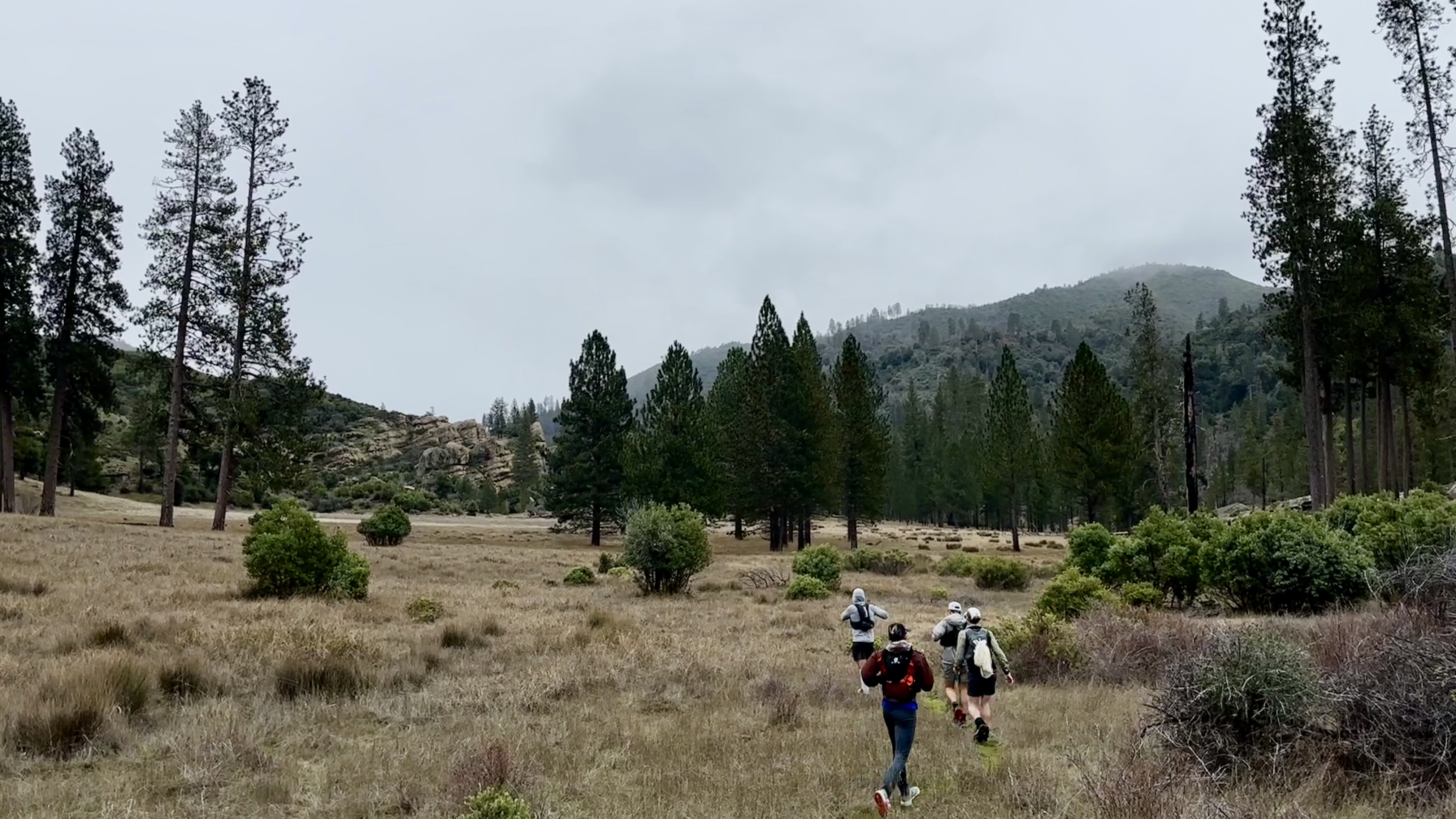
A week’s notice isn’t much time to prepare for an epic all-day wilderness traverse, but I wasn’t going to turn down an opportunity to run across the Santa Lucia mountains, through the Ventana Wilderness from Carmel Valley to Big Sur. When my friend Will asked me if I wanted to join the group that was assembled for the trip, I happily abandoned my plans to race a half marathon, confirmed my dog sitter’s availability, and committed to the crew! I joined Rob, Martin, Will, Amos, and Liem for the quick trip - we drove down Friday after work, ran Saturday, and returned late on Saturday night.
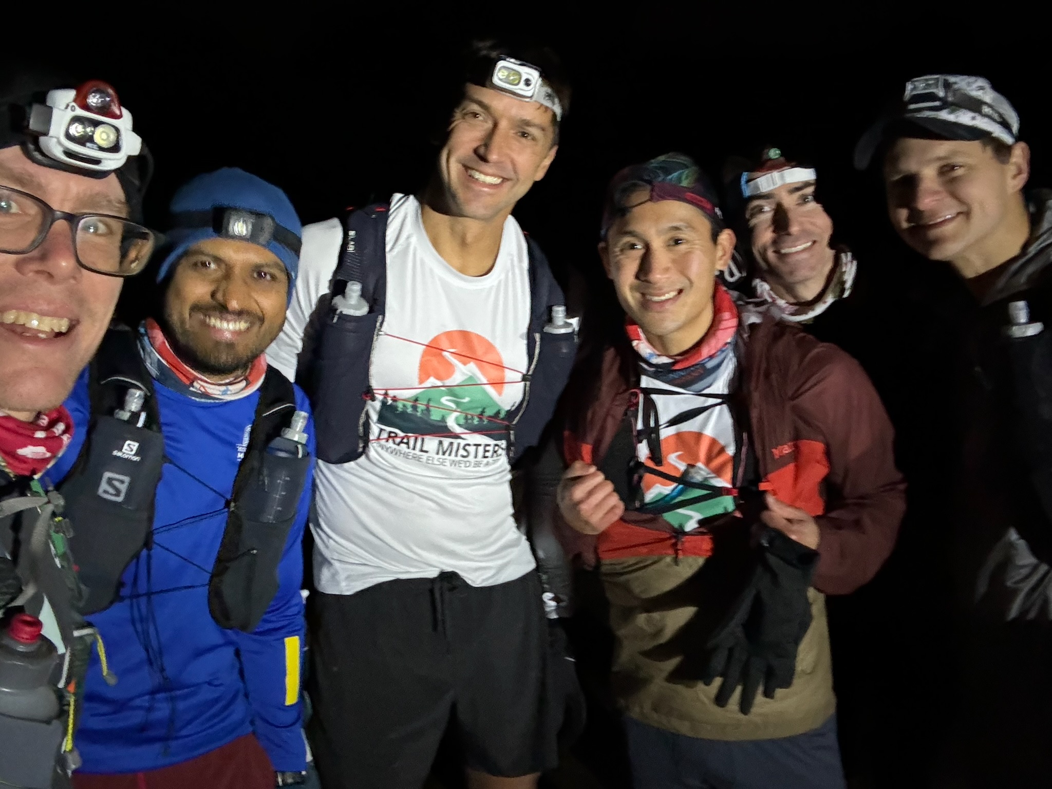
The group at the start.
The Route
Rob put together this epic route which connected the Carmel River, Bear Basin, and Pine Ridge trails for a total of 31.2 miles and 5,976 ft of elevation gain. The real route ended up being 32.4 miles and 8,786 ft of gain (!!!). We thought it would take 8 hours, and it took 12. We thought we’d be done well before dark, but it took us nearly 5 hours to cover the first 10 miles.
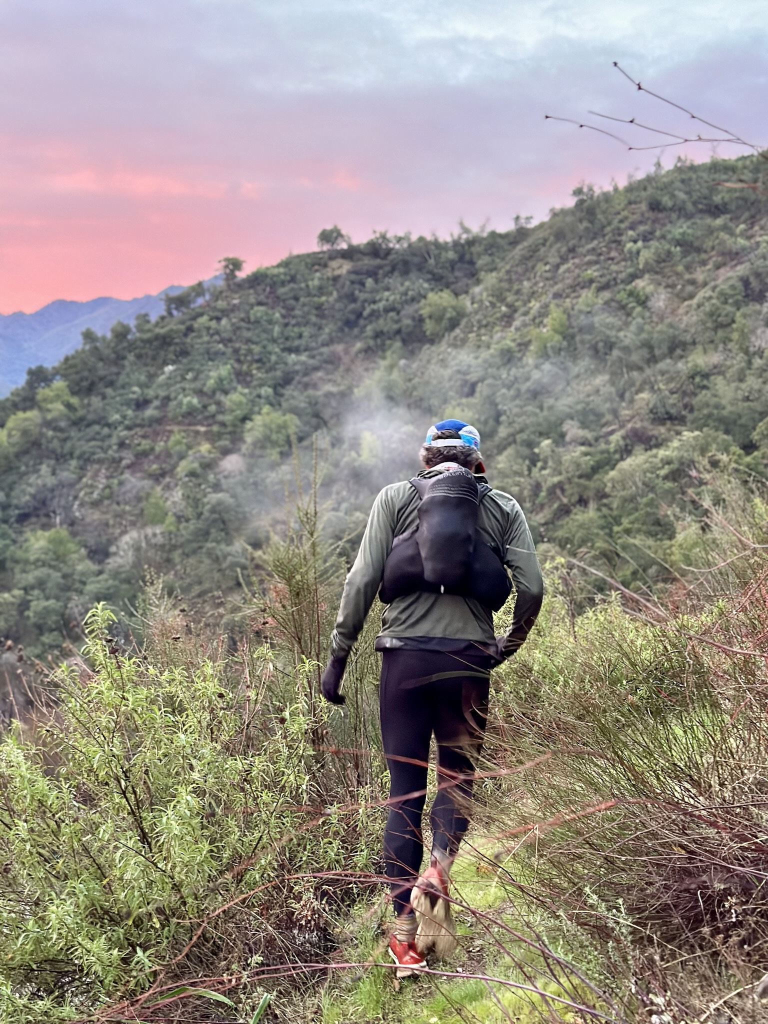
Getting started in the early morning hours.
The first 12 miles were far, far more difficult than we anticipated, mainly due to two things: the Carmel River had a lot of fast-flowing water, and the Carmel River trail is very overgrown and difficult to find at times. Fortunately, with a group of 6, we were fairly confident and capable of supporting each other. I would’ve almost certainly bailed early if this were a solo, or maybe even a partnered attempt.
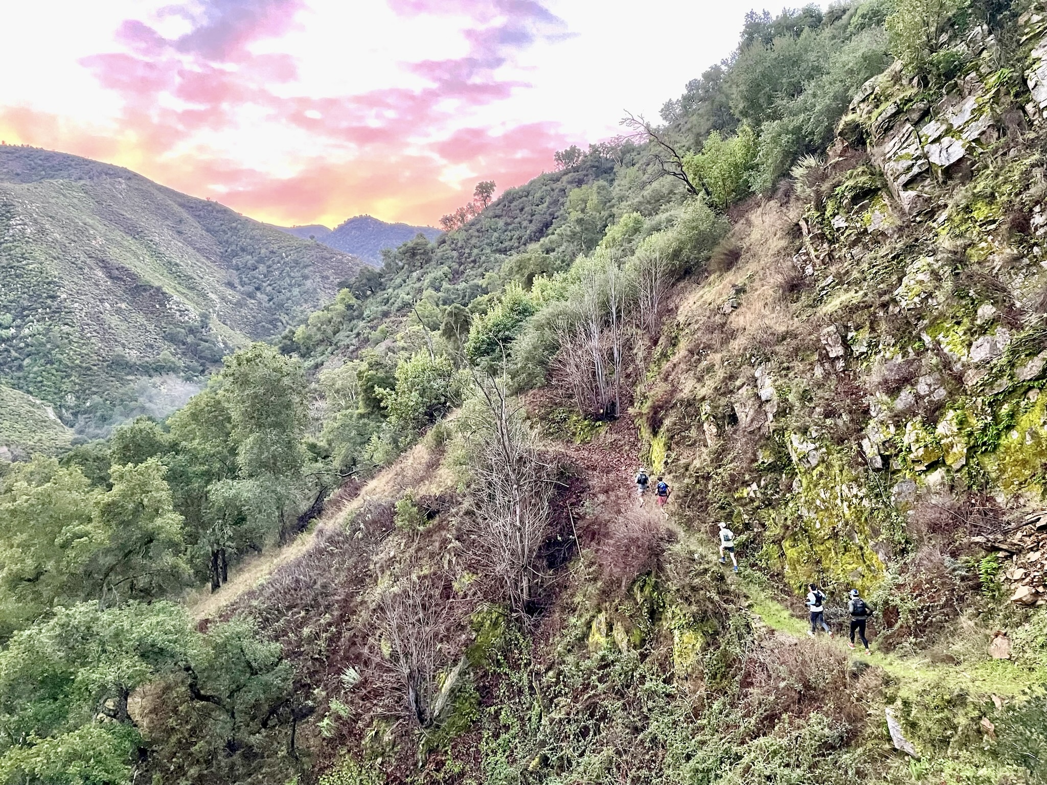
Into the mountains.
The Carmel River Trail
We started in the dark, crossing the dam and route-finding our way by headlamp on the recently-repaired and rerouted trail. Route-finding would become a main theme for the morning as we navigated around many fallen trees and landslides. Liem slipped and fell into the river up to his neck at the very first water crossing. Will gave him a dry shirt to change into on the far side, but I’m not sure how much good it did in the long term because we ended up crossing the river dozens of times, with fast-flowing water up to our waists. It was very, very difficult to maintain footing, even with huge walking sticks that we found or made to support us in the water.
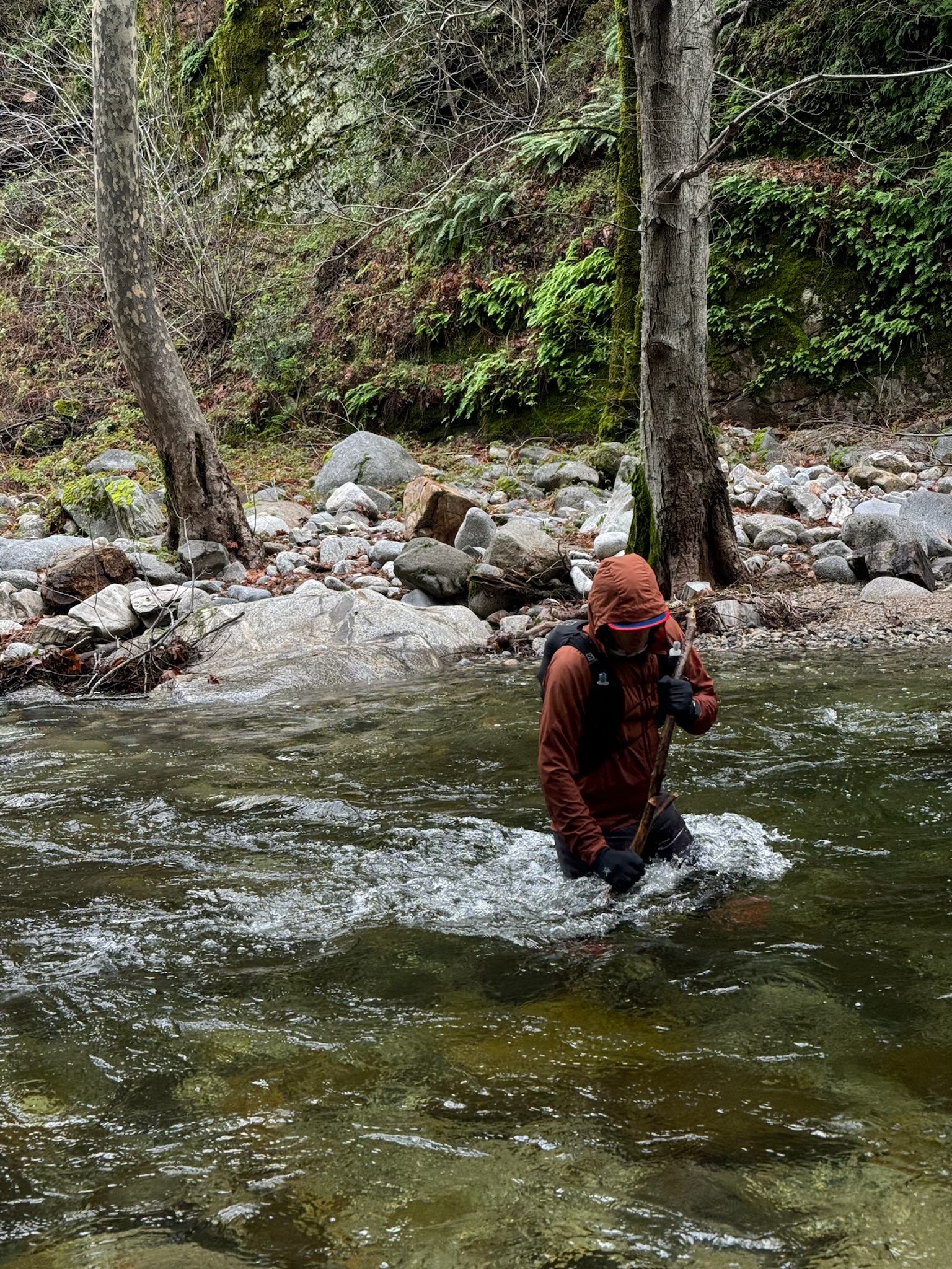
One of dozens of river crossings.
When we finally made it out of the river section of the trail, the heavily-overgrown brush became the next obstacle to overcome. We completely lost the trail at times and had to call out to each other to communicate, because the brush made everyone invisible. I hiked for miles with my forearms held in front of my head like I was defending myself from punches to the face. I was very glad that I had chosen to wear tights, gloves, and a long-sleeved shirt for the extra protection that I was provided - anyone with exposed skin got a lot of scrapes.
Pine Valley
Pine Valley
Finally, after hours and hours of being soggy, we emerged over the saddle point of the drainage and found ourselves on a fairly well-maintained fire road that descended into a beautiful valley. We ran past the cabin built by Jack English, which is worth researching for a climpse into the interesting history of homesteading and land use in the west. It was easy to find our way on to the Bear Basin Trail and begin climbing our way out of the valley, toward the high points of the route.
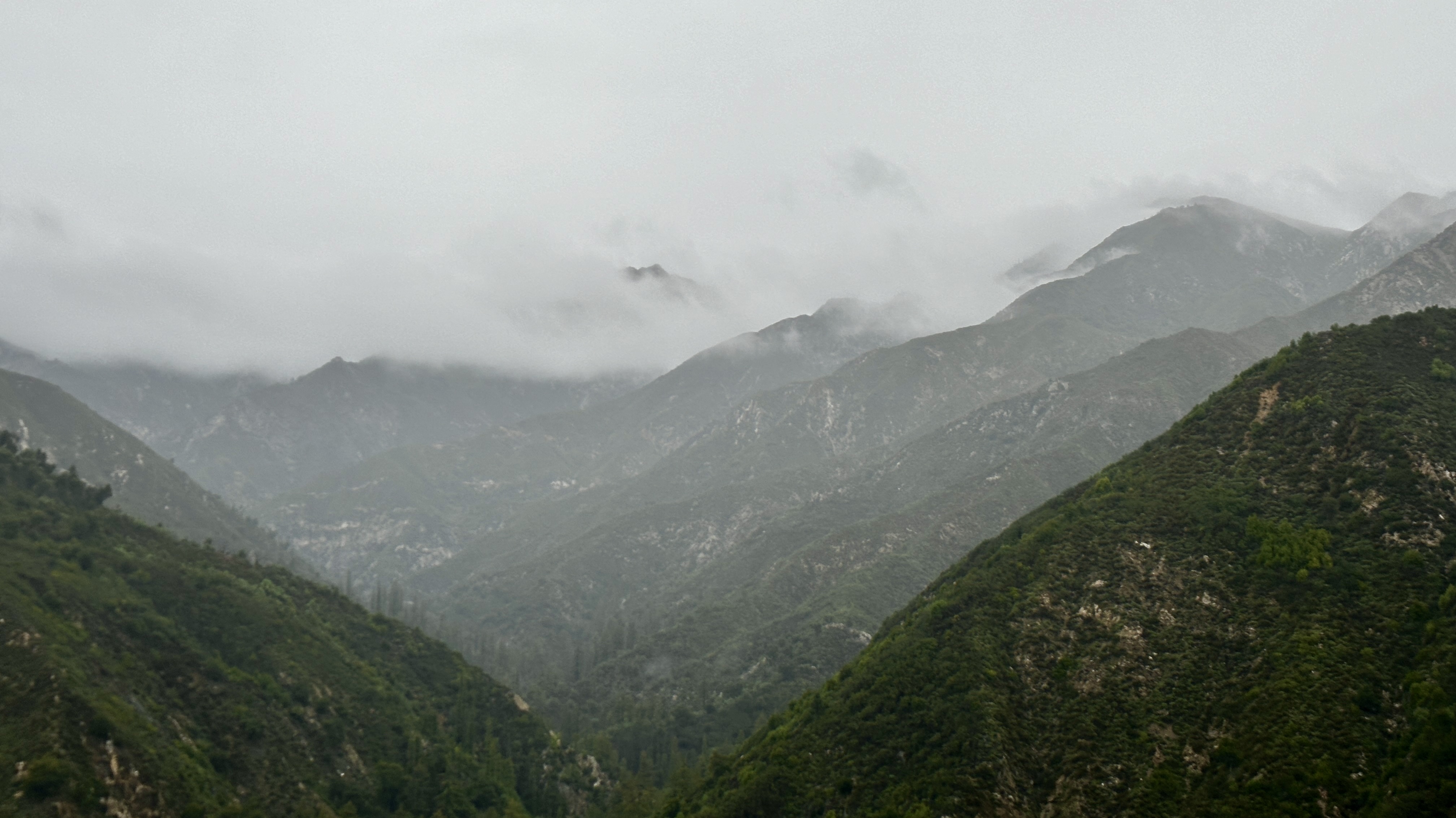
Santa Lucia Ridgelines
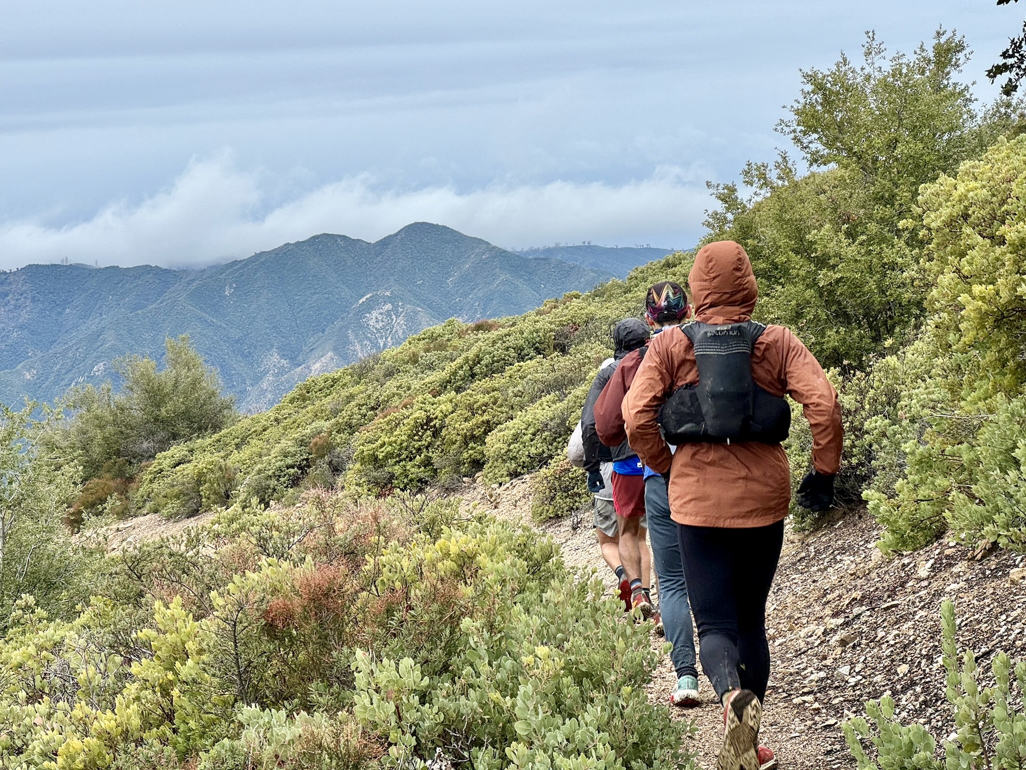
Crossing the high country portion of the route.
It started snowing as we entered the “high country” part of the route (above 4,000 ft elevation). The views up there are absolutely incredible - nothing but mountains and river valleys in ever direction, except for where the Pacific Ocean meets the Santa Lucia range. The trails from this point onward were in much better shape than the Carmel River Trail. The feeling among the group was that Pine Valley and these high-country trails had forced an evolution of our experience from mostly Type 2 to mostly Type 1 fun.
Pine Ridge Trail
The Pine Ridge descent was absolutely epic. Like, good enough to earn a spot on the all-time great descents of my life. It was that good. Smooth California carpet underfoot, steep dropoffs that made it just a little spicy for running, and uninterrupted views of the surrounding mountains and valleys. I was so stoked to turn every corner. The descent was smooth and uninterrupted for miles and miles.
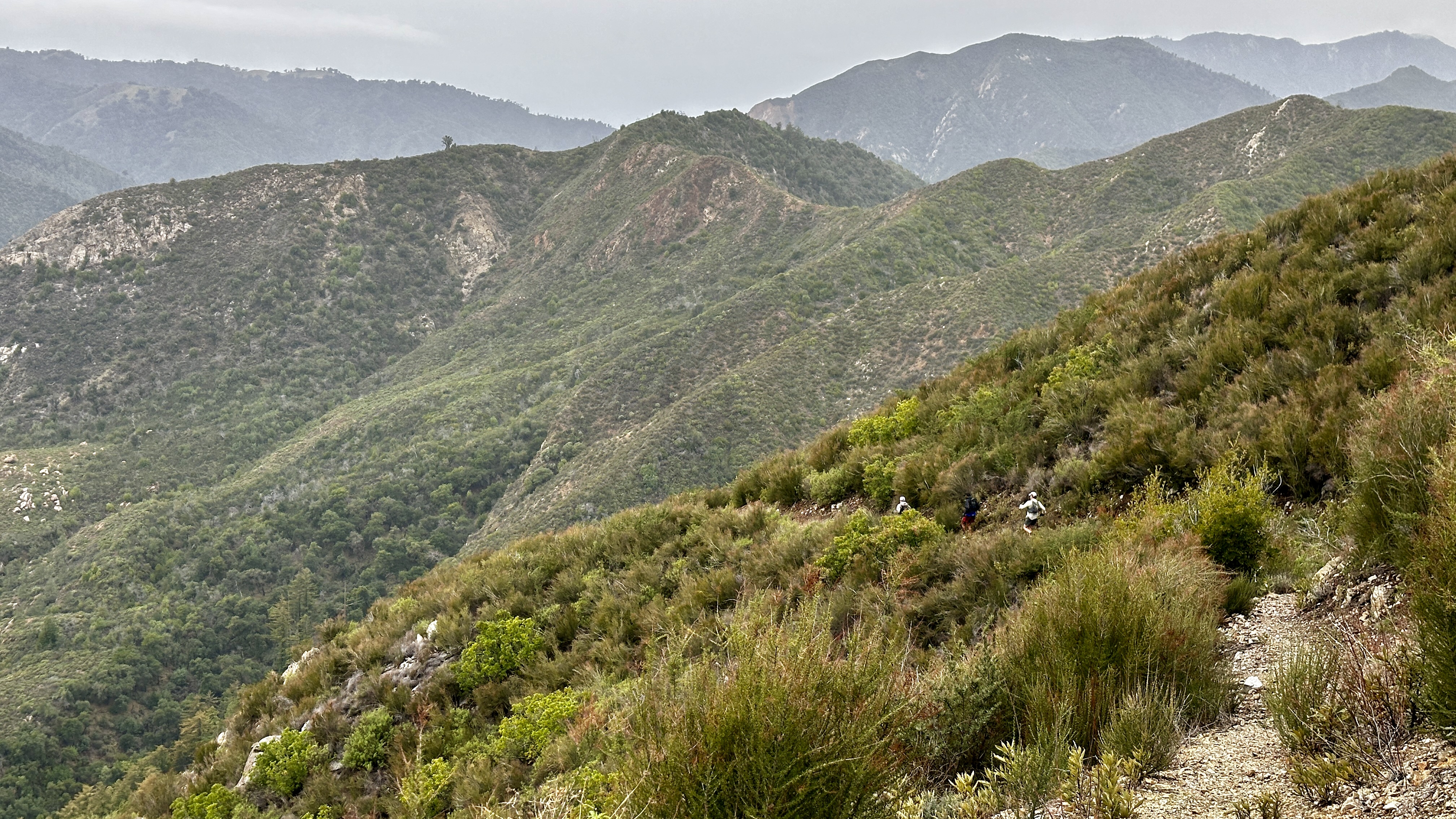
Epic descending
… and miles.
Eventually the trail dropped back into the forest, which was yet another treat because we began weaving in and out of the occasional redwood grove on our way to the Big Sur River crossing. Right around the time that we got to the river, it started to rain lightly, but steadily. The rain wouldn’t let up for the remainder of our day. Some of the group went to the Sykes hot springs, but I stayed back because I needed to filter more water and I was starting to get cold. I adjusted my layers and prepared for the next few hours of cold and wet running. The hot spring itself sounded lovely, but the experience of getting out in the cold, and getting dressed again in the rain, sounded like it would set myself up for misery for the rest of the journey.
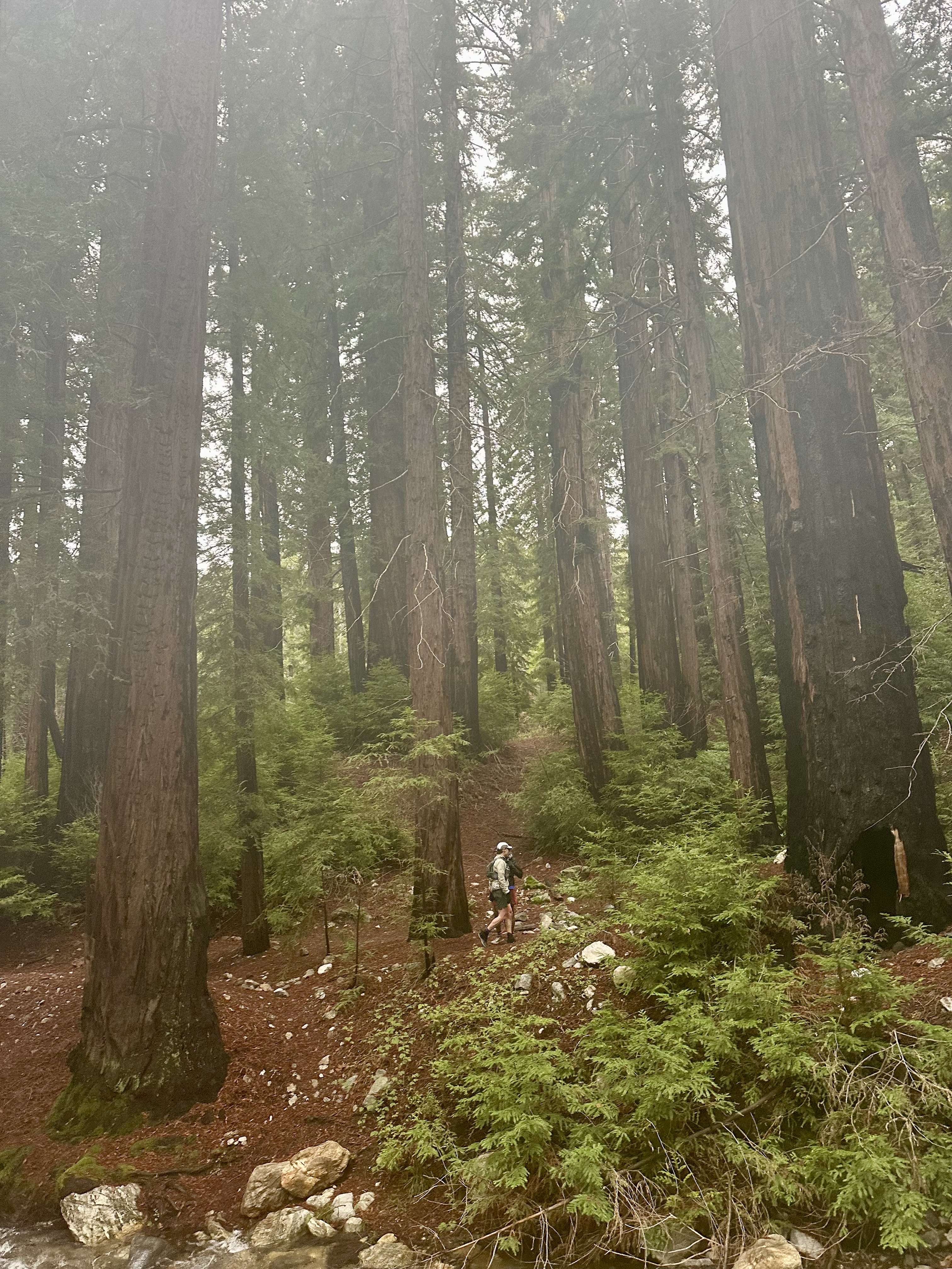
Taking a break in the redwoods.
We had to pull our headlamps back out for the last few miles. The Pine Ridge trail was extremely well-maintained and very runnable. I’d love to come back to run it in the light, maybe during dry and warmer weather. Eventually we made it to the car (we had shuttled it the night before) and left to retrieve our vehicle from the start.
The last photo of the mountains before the rain rolled in.
All in all, the route and experience definitely belong in the “epic” category. I’d definitely do it again, although not in winter - we didn’t consider the risk of an impassable Carmel River, and that ended up being a significant risk to manage many, many times throughout the first part of the day. Rob, Will, Amos, Liem, Martin, and I made a solid crew together and we all had a great and memorable day.
Poison Oak Addendum
Several days after the run, a few of us started chatting about our skin rashes. I ended up getting a steroid prescription for some of the worst poison oak rash that I’ve ever had in my life. Note to self: anytime there’s bushwhacking in California coastal wilderness, bring the Tecnu!
FKT Addendum
I submitted the route for consideration on fastestknowntime.com, but it was rejected because there isn’t enough evidence to believe that this is a “significant/well known/popular traverse”. This is a disappointing change from my prior experience submitting routes for consideration on the site - it used to be that a new route with significant features in an under-represented landscape would be considered and likely included. I’ve had routes accepted for inclusion on the site in the past. There are very few established routes in Big Sur, so I would’ve thought that this route would mark a significant way to experience the region. Since the site was bought by Outside Online, they’ve changed their policy and now apparently only add routes that are well-known… which makes me wonder, how does a route become well-known if it’s never discoverable on sites like FKT in the first place?
I guess adventurous runners will have to discover routes like this the old-fashioned way: word of mouth and pure imagination. Fastestknowntime.com is going to become stale and irrelevant for discovery of new routes, which is unfortunate because it used to be a place that I’d go for inspiration. Outside has slowly started to kill the site.